 Hike Date: 06-09-2015
Distance (Roundtrip): 3 miles
Elevation Gain: 1330 ft
Highest Point: 5052 ft
Mount Catherine Hiking Guide
It's been awhile since my last hike, but with the weather being so nice in Seattle lately, I was due for a trip out to the mountains. Today, there was nothing but sun and clear skies in the forecast. So, I decided to make a weekday, hour-long drive out to Mount Catherine! The trailhead is on USFS road 9070, which is at exit 54 (Hyak) off I-90. There is a small, three-car parking area on the left with a sign with the numbers "1348" marking the trailhead. The hiking guide provides more detailed directions. A Northwest Forest Pass is required, so have it ready!
At around 9am, there were no other cars parked at the trailhead. The sun was out without a cloud in the sky!
 This hike is a thigh-burner! It starts off with a steady incline through the shade of the forest canopy. The trail begins to switch back and forth steeply along the western side of the mountain, with a couple of views peeking through the trees. It is mostly well-kept, a bit rocky in the beginning, but smooths out nicely further along. There is a downed tree blocking the trail at one point, but it is very easy to hop over. The climb along the western side of the mountain is just under a mile long. Then, it levels off along a ridgeline.
The ridgeline provides a nice little break from the steep incline at the start of the hike. However, this is short-lived, as the final half-mile stretch to the top climbs upward once more. The trail is still in great condition at this point. However, there are a couple of muddy areas and another downed tree, which is really easy to duck under. At what appears to be a small camping area, the views really start open up. The summit isn't much further from this spot.
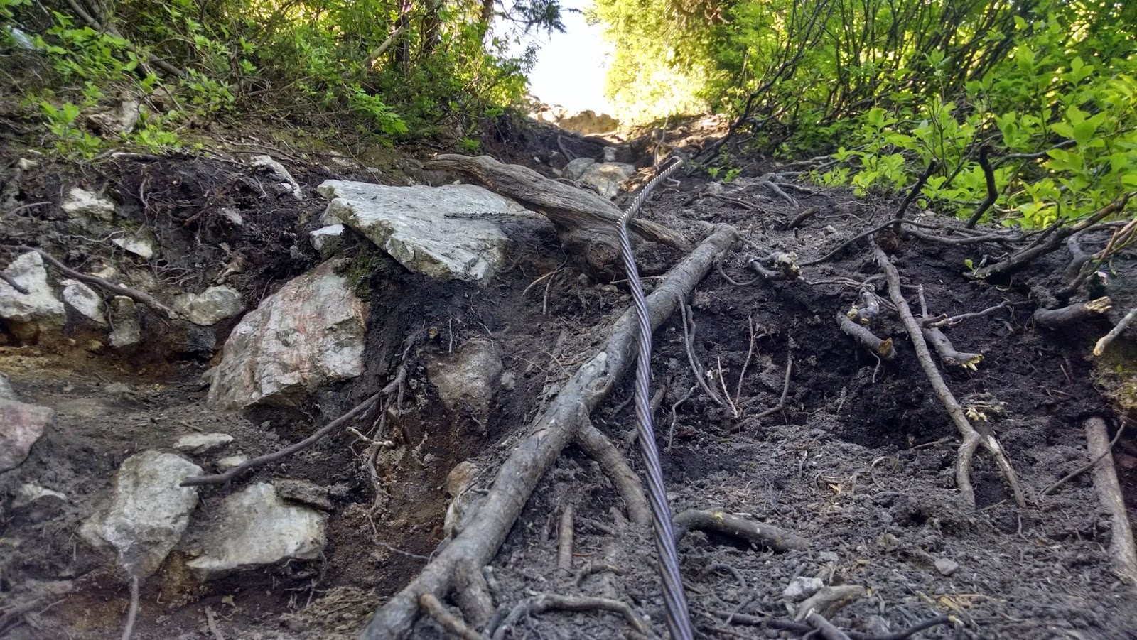 Just beneath the summit of Mount Catherine, there is a long cable to assist with the final, 20-foot scramble to the top. It's a little daunting, but nothing too crazy. Once at the top, a 360-degree view all around the Snoqualmie pass greets you!
The views from the summit of Mount Catherine are some of the best views I've ever seen on any hike! There is a stunning, unobstructed view of Mount Rainier. Over to the right of Mount Rainier are the Tinkham and Silver Peaks (two other hikes along USFS road 9070). To the north, Chair Peak, Kaleetan Peak, Red Mountain (which actually looks red), and Snoqualmie Mountain are clearly visible. And down below, the blue waters of Keechelus Lake glistens in the sun. It was absolutely breathtaking!
It took about 35 minutes to reach the summit at a brisk pace from the trailhead without any breaks. After soaking up the sun at the summit for awhile, it took about 30 minutes to get back down to my Jeep. It's a bit of a drive from Seattle, but I'd gladly recommend the quick, steep hike up Mount Catherine to anyone who wants to see some of the best views in the Snoqualmie area!
Photos


No comments:
Post a Comment