 Hike Date: 03-02-2013
Distance (Roundtrip): 7 miles
Elevation Gain: 625 ft
Highest Point: 750 ft
Lime Kiln Trail Hiking Guide
There are many great mountain hikes all over the Pacific Northwest, but during the winter time, I enjoy hiking lower altitudes. It's a nice break from avalanche danger, icy surfaces, and blistering cold winds. Today, my girlfriend and I explored the historic Lime Kiln Trail. It is located just outside of Granite Falls near the entrance of Robe Canyon Historic Park. We reached the unpaved parking lot at 9am. There were only two other vehicles. The sky was gray, but it wasn't too cold or rainy. Typical northwest hiking weather!
 The beginning of the trail is mostly flat with gradual dips and climbs through very mossy trees. It is mostly well-kept, with occasional mud holes and horse droppings. The first mile of the trail allows horseback riding, but reaches a point where only hikers are allowed. Part of the trail goes through private property. So, it's very important to stay on the trail.
The trail opens up along an old road. It's wide enough for two people to walk side-by-side. It was still morning, but it was nice to catch what little sun broke through the clouds. The old road snakes its way past Hubbard Lake and to up to a junction. There is a clearly marked sign that directs hikers off the main road towards a small trail to the left. This leads to the Lime Kiln.
 At this point, there is a noticeable drop in altitude as the trail makes its way towards the roaring Stillaguamish river, also known as Stilly. It follows the river along old the Everett and Monte Cristo Railway. These historic parts of the trail are marked by signs. We took time to pause and gaze at the mossy trees and cliffs as they dripped with streams of rain water. Moving further, we realized the trail had been modified to cross over a landslide. It isn't obvious, but gazing to the right showed a huge chunk of mud and rocks missing from the side of the cliff.
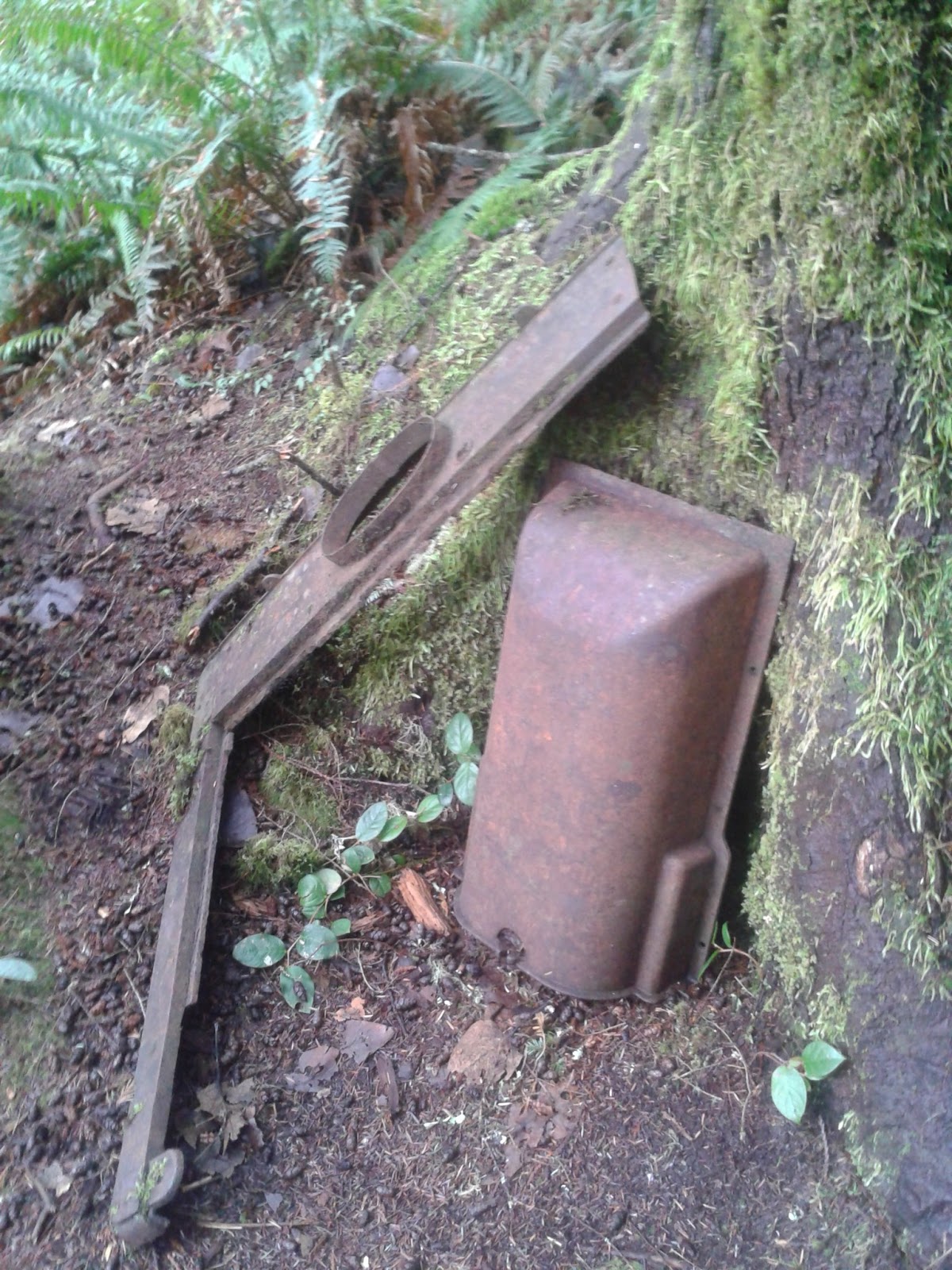
There is plenty of moss covering the trees and rocks, but we kept our eyes peeled for old artifacts left by loggers and miners of the past. We found old cookware, railroad pieces, and saw blades. Everything was rusted through and really fragile, so we left it alone. At about 2.5 miles, the old Lime Kiln towered through the trees. We explored around, snapped some photos, and headed towards the end of the trail for lunch.
After about another mile, we reached the rocky shores of the South Fork Stillaguamish. During this time of the year, the river is roaring. It's pasty green color quickly breaks into whitewater as it maneuvers over boulders and rocks. This spot is perfect for lunch. We took a load off and snapped some photos along the river. It was roughly 10:15am, so it took about an hour to get to the end of the trail.

We made our departure towards and old railway crossing. Though the railroad is gone, the foundation still stands. It's difficult to see, but we managed to snap some photos of it through the trees. It wasn't anything spectacular, so we quickly turned around and made our way back to the trailhead and parking lot.
We returned in about the same time it took to get to the river (1 hour). By this time, the parking lot was full. Overall, this is a great little hike and a nice break from the typical mountain climb.
Photos


No comments:
Post a Comment